 Version française
 Modelling the present strain and velocity fields of Central South-East Asia
The results obtained are crucial to precise and predict the style and timing of deformation in the active basins (particularly the Makassar basin) which are presently explored by the oil industry, but also to provide useful data to environmental hazard studies of active and passive margins. The project was funded by UNOCAL. |
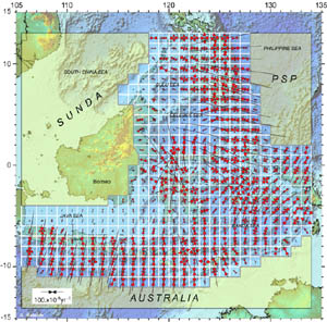
In this complex area, it was a real challenge to use the diffuse model devised by Haines and Holt (1993) to calculate coherent strain and velocity fields. The boundary conditions were correctly set by accounting for the movements of the three surrounding plates, Sunda, Australia, and Philippine Sea Plate. More than 10 years of GPS measurements were used as input data, with the deformation styles inferred from the Harvard CMT catalog (starting 1976; relocated with Engdahl locations) as constraints. 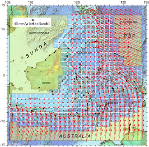
|