 Version française
 -
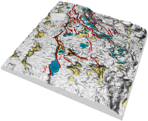
Integration of multi-beam bathymetry, seafloor acoustic reflectivity, and seismics
Recent qualitative advances in multi-beam bathymetry allow now to achieve very high resolutions in seafloor mapping. To gain insight into sub-surface formations, there is a clear need for multi-tool / multi-scale integration with other geophysical measurements, such as:
- acoustic reflectivity
- 2D/3D seismics
- 3.5 kHz mud penetrator
- coring
- in-situ fluid sampling
When available, well data (well-logging, geometry, geochemistry), regional geophysics (gravity, magnetics, heat flow) and core data can be used to constrain the interpretation and refine the picture. This integration results in 3D high resolution mapping of structures such as active faults, fluid paths, potential slope failures, areas of potential under-consolidation, in sensitive geological contexts such as unstable margins and deforming basins.
 On the right is an example of a quantitative analysis of seafloor acoustic reflectivity by image analysis that we have developed. This technique qqallows to determine the seafloor expressions of gas/fluids/mud expulsions. These features are known to be partly correlated with local and regional deformation in tectonically active areas. When combined with core analysis or 2D seismics, it becomes possible to infer volumes of expelled material or draw the geological history of the area.
We use a variety of specialized softwares that we may combine to obtain clearer and easy-to-use intermediate and final results:
- Data analysis and cartography: Caraibes, GMT, Fledermaus, ENVI
- GIS: MGE Microstation, Geomedia, Global Mapper
- Image analysis: ENVI, NIH Image
- Seismics: GeoVector, SU, Geographix
These studies are applicable to
- field exploration
- site surveys
- geohazard appraisal
-
Formation evaluation and reservoir appraisal
Geology: Core description, sample selection, thin section analysis (optical and electronic microscopy), multi-sensor track operating, calibrating and interfacing.
Geophysics: Well-logging data normalization, quality control, analysis and interpretation.
In addition to the classical interpretation methods (QuickLook methods like log-core and multi-well correlations, synthetics construction), we master original and innovative analysis schemes to interpret well-logging data in terms of sediment physical properties and mineralogy (both qualitative and quantitative). We use multivariate statistics, inversion methods, neural networks and Bayesian inference to calculate continuous profiles of mineralogy (major and accessory minerals) and petrophysical properties (densities, porosities, permeability, CEC, thermal conductivity, mechanical and acoustic parameters, water saturation), and eventually describe the sedimentary pile in terms of fluid flow, fluid and thermal alterations, under or over-compaction and over-pressures.
We use innovative and efficient techniques developed and tested in many geological environments, to achieve integration, visualization and interpretation of multi-scale geological, geophysical and geochemical data. Our two areas of expertise are: